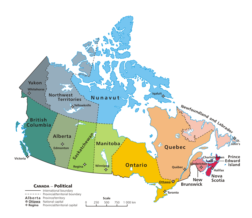
 Canada is a big country - the biggest in the world after Russia - and divided into many parts that might be nice to know more of for those of us who never visited this great country.
So here below you see the provinces and territories - in both English and French - with their official two-letter abbreviations and also the capitals. These abbreviations will be used throughout the site.
AB
Alberta
Edmonton
BC
Colombie-Britannique
Victoria
MB
Manitoba
Winnipeg
NB
Nouveau-Brunswick
Fredericton
NL
Terre-Neuve-et-Labrador
St. John’s
NS
Nouvelle-Écosse
Halifax
NT
Territoires du Nord-Ouest
Yellowknife
NU
Nunavut
Iqaluit
ON
Ontario
Toronto
PE
Île-du-Prince-Édouard
Charlottetown
QC
Québec
Québec City
SK
Saskatchewan
Regina
YT
Yukon
White Horse
Sources: http://www.comeexplorecanada.com/abbreviations.php https://en.wikipedia.org/wiki/Provinces_and_territories_of_Canada Updated 14.6.2018